

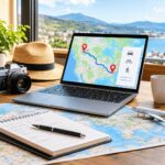












































A memorable trip is not just about choosing beautiful destinations. It is also about understanding how far apart those destinations are and how much time it takes to travel between them.
Many travelers spend hours researching hotels, attractions, restaurants, and activities but overlook one important part of their itinerary: transportation distance. A destination might look relatively close on a map, yet reaching it could require several hours of driving because of road layouts, geographical barriers, or limited transportation options.
Understanding travel distances before leaving home can make a significant difference. It helps travelers organize their schedules, choose practical routes, manage transportation expenses, and avoid spending more time traveling than enjoying their destinations.
Whether you are planning a weekend getaway, an international vacation, or a road trip involving several cities, here is how to approach distance planning more effectively.
Why Travel Distance Matters When Planning a Trip
Distance influences almost every part of a travel itinerary. It determines how much time you need between destinations, which transportation options are practical, and how many activities you can comfortably fit into a day.
For example, visiting two attractions in the same city might require only a short drive. However, traveling between two popular cities could take several hours, even when their locations appear relatively close on a map.
Ignoring these differences can create an unrealistic schedule.
Before confirming accommodation or booking activities, consider the distance between your starting point, major attractions, and overnight destinations. This simple step helps you understand whether your planned itinerary is manageable.
It also gives you more flexibility to adjust your schedule before making non-refundable bookings.
Understand the Difference Between Straight-Line and Travel Distance
One common mistake travelers make is assuming that the geographical distance between two places represents the distance they will actually travel.
These measurements are different.
Straight-line distance measures the shortest geographical separation between two locations. It is often described as the distance as the crow flies because it ignores roads, buildings, rivers, mountains, and other physical obstacles.
Travel distance, on the other hand, measures the distance covered along an actual transportation route. It depends on available roads, walking paths, cycling routes, and other connections between the starting point and destination.
Consider two cities separated by a mountain range. Their straight-line distance might appear relatively short, but the actual driving route could be considerably longer because roads must follow the available terrain.
The same issue occurs when traveling between destinations separated by rivers, lakes, or coastlines.
Understanding which measurement you need is essential. Straight-line distance can help compare geographical locations, while actual travel distance is generally more useful when organizing a road trip or estimating how far you will walk or cycle.
Calculate Distances Before Choosing Your Destinations
Once you have selected a few destinations, check the distances between them before finalizing your itinerary.
A useful approach is to create a simple list of the places you intend to visit and estimate the journey between each pair.
For example, imagine planning a vacation involving three cities:
- Your arrival destination.
- A second city where you want to spend a day sightseeing.
- A final destination where you plan to stay for several nights.
Instead of checking only the distance from your arrival airport to the first hotel, calculate the distances between all three locations.
This gives you a clearer picture of the total transportation involved.
A free distance calculator can help with this process. Enter your starting location and destination to find their distance in kilometers, miles, and nautical miles. You can also compare driving, walking, and cycling routes using an interactive map.
Having these measurements available makes it easier to compare destinations and organize your travel schedule before departure.
Choose the Right Transportation Method
The shortest route is not necessarily the most convenient option. Your transportation method can significantly change both the distance and time required to reach a destination.
Before selecting your preferred route, consider how you intend to travel.
Driving
Driving is often convenient for road trips, family vacations, and journeys involving destinations that are difficult to reach using public transportation.
However, the driving distance can differ considerably from the geographical distance.
Road networks, highways, toll roads, traffic restrictions, and available crossings all influence the route. A journey that appears short on a geographical map might require a much longer drive.
When planning a driving itinerary, consider the actual road distance rather than relying exclusively on straight-line measurements.
Walking
Walking is a practical option for exploring compact cities, historic neighborhoods, parks, and nearby attractions.
However, walking routes do not always follow the same paths as driving routes. Pedestrian shortcuts, public pathways, restricted roads, and access points can change the distance considerably.
If you intend to explore a destination on foot, check walking distances separately instead of assuming that driving estimates will be accurate for pedestrians.
Cycling
Cycling can be an enjoyable way to explore scenic destinations and cover distances that might be too long for walking.
However, cyclists need to consider more than the distance alone. Road conditions, elevation changes, dedicated cycling paths, and traffic conditions can all influence the experience.
Checking a cycling-specific route before departure helps you make more realistic decisions about daily travel distances.
Allow Enough Time Between Destinations
Knowing the distance between two places is only part of the planning process. You also need to estimate how long the journey will take.
A 100-mile journey might take less time on an open highway than a 30-mile journey through a congested city.
Several factors can influence travel time:
- Traffic congestion during peak hours.
- Road quality and speed restrictions.
- Weather conditions.
- Rest stops and meal breaks.
- Border crossings and security checks.
- Parking availability near popular attractions.
For this reason, avoid building an itinerary around the assumption that every journey will take exactly as long as its estimated travel time suggests.
Leave some additional time between activities, particularly when traveling with children, older family members, or a large group.
A flexible schedule is usually more enjoyable than one that requires you to rush from one attraction to another.
Plan Multi-Stop Trips Using a Logical Route
Travelers visiting several destinations during one vacation should pay particular attention to the order of their stops.
Choosing destinations without considering their geographical positions can result in unnecessary backtracking.
For example, imagine visiting four attractions spread across a large region. Traveling from the first attraction to the fourth and then returning to the second could add unnecessary mileage.
Instead, arrange your destinations geographically.
Start by identifying the closest locations and grouping attractions that can reasonably be visited on the same day. Then organize the remaining destinations according to their distance and accessibility.
A map can make this process much easier because it allows you to visualize the relationship between different locations.
You should also consider where you will spend each night. Sometimes staying closer to your next destination is more practical than returning to the same hotel every evening.
This approach can reduce unnecessary transportation and leave more time for sightseeing.
Consider the Total Travel Cost, Not Just the Distance
Longer journeys often involve additional expenses, but distance alone does not determine the overall transportation cost.
Fuel consumption, toll charges, parking fees, public transportation fares, and vehicle rental expenses can all influence your travel budget.
For example, two routes might cover similar distances but have different costs because one uses toll highways while the other follows ordinary roads.
If you are traveling with family or friends, these differences can become particularly important.
Before committing to a route, consider:
- The estimated fuel or transportation cost.
- Possible toll charges.
- Parking expenses at your destination.
- Additional accommodation costs if an overnight stop is necessary.
- Whether public transportation offers a more practical alternative.
Combining distance calculations with basic expense estimates gives you a better understanding of what each journey will actually cost.
Use Digital Maps and Distance Tools to Prepare
Modern travel planning is much easier because travelers can access digital maps and route-planning tools before leaving home.
These resources help you compare destinations, understand geographical layouts, and identify practical transportation options.
A useful distance-planning tool should allow you to enter different types of locations rather than limiting searches to major cities.
For example, you might want to calculate the distance between an airport and a hotel, two national parks, or a specific landmark and a nearby town.
Interactive maps are particularly useful because they provide a visual understanding of the journey instead of presenting only a numerical distance.
You can also compare different travel modes to understand how the route changes depending on whether you are driving, walking, or cycling.
However, remember that estimated travel times are not guarantees. Always check current road conditions and navigation information before starting your journey.
Build a Flexible Itinerary That Leaves Room for Exploration
Even the most carefully researched travel plan should allow some flexibility.
Unexpected delays, weather changes, local events, and spontaneous sightseeing opportunities can affect your original schedule.
Instead of planning every hour, organize your itinerary around a few important activities and realistic travel windows.
For example, if you plan to visit two attractions in different parts of a city, avoid scheduling them too close together. Allow enough time for transportation, meals, and unexpected delays.
Travelers who are still developing their overall vacation plans can also explore these essential tips for every aspiring tour traveler to make better decisions about destinations, budgets, and daily activities.
It is also worth grouping nearby attractions together. This reduces unnecessary journeys and gives you more opportunities to explore each area at a comfortable pace.
Good travel planning is not about visiting the maximum number of places. It is about making the most of the time available.
Final Thoughts
Travel distance is one of the most important details to consider when building a realistic itinerary. Understanding the difference between geographical distance and actual travel distance helps you make better transportation decisions, manage your budget, and avoid unnecessary delays.
Before finalizing your next vacation, take a little time to calculate the distances between your destinations. Compare different transportation options, allow reasonable travel times, and organize your stops in a logical order.
A well-planned journey gives you more freedom to enjoy the places you visit rather than worrying about how to get from one destination to another.
Ultimately, the best itinerary is not necessarily the one that covers the most miles. It is the one that makes every part of your journey worthwhile.
